
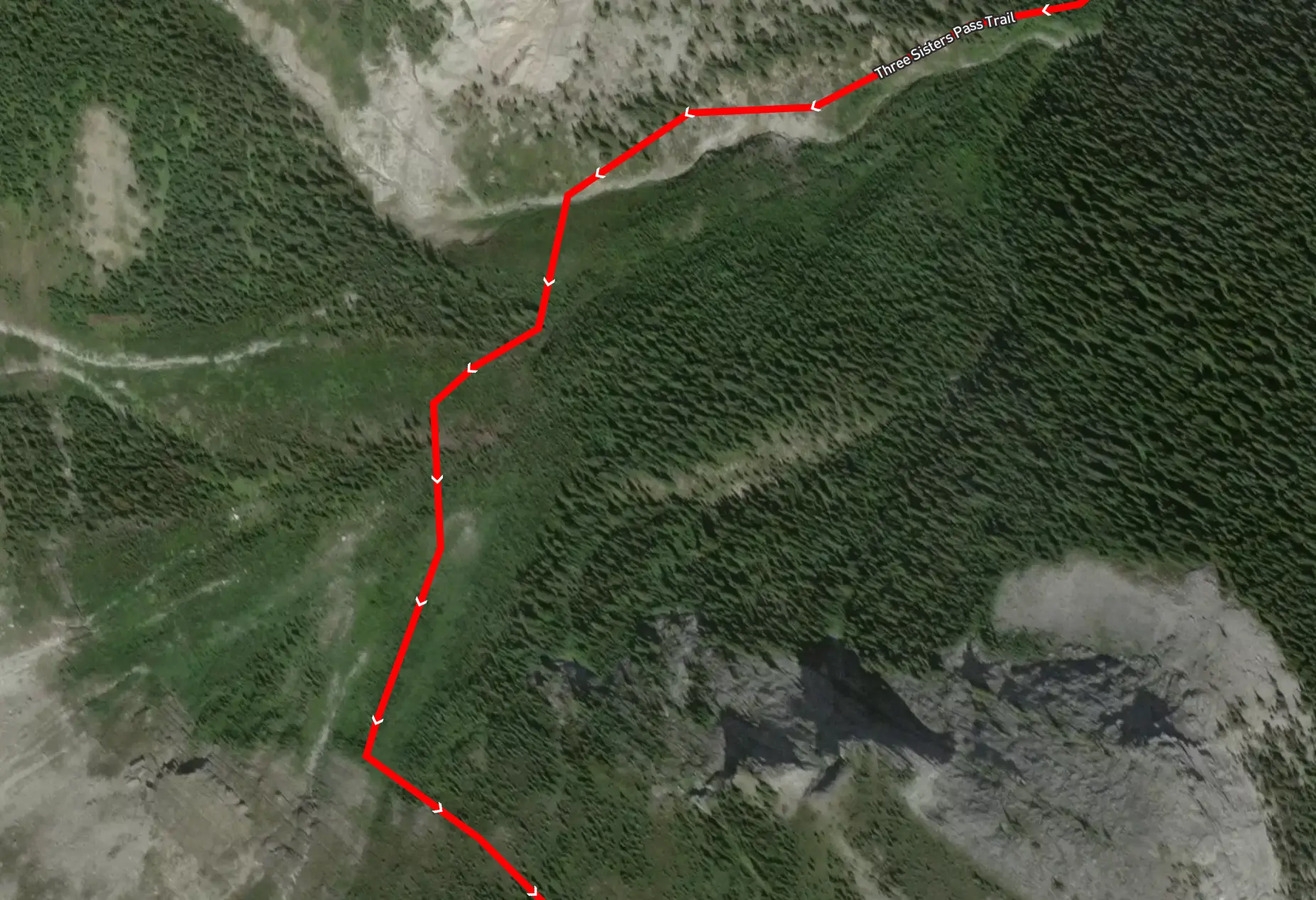
This is a trail I had been looking at for a while, partly because I hadn't heard of anyone trying it previously, partly because I could do it from our doorsteps in three sisters. I knew there was a trail down the other side, making it an interesting point-to-point adventure. Alltrails indicated that there was a route through, so after finishing work at 5 PM I set off.
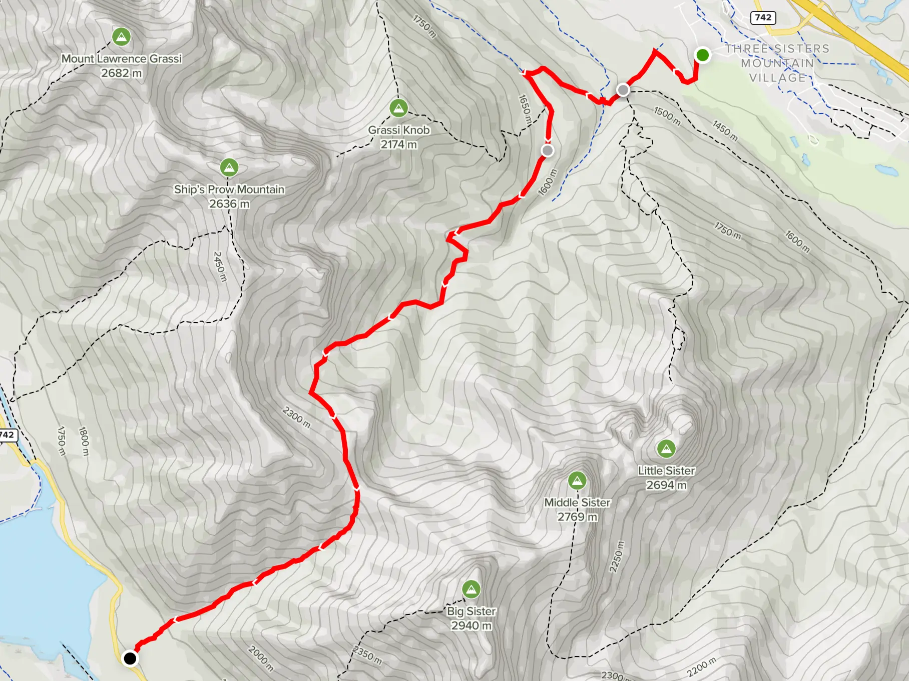
Starting at the Highline, the trail is great and one I know well, as SE route of Grassi Knob is another great hike right from our doorsteps. Rather than taking the trail up through the trees towards Grassi Knob, I cross over the indicator log and keep going in that direction. The trail was reasonably well defined through the trees, although I ended up getting off course a few times. I kept my phone on hand for verifying my route throughout the day.
After a while, the trail meets with a rocky creek, marked clearly with a cairn, which I suspect is an indicator for folks coming in the other direction. The rocky creek was slow-moving, but the occasional cairn indicated that I was heading in the correct direction.
Eventually, my creek met up with another creekbed. After verifying on my map that this was my turn, I followed it to the right and upwards. It wasn't an overly steep climb, just a moderately defined route, but I knew I just had to head upwards. There was one steep cliffy section of the creek where I strayed off to the right up a loose dirt slope to work my way around. At the top of this steep section is where I ran into trouble.
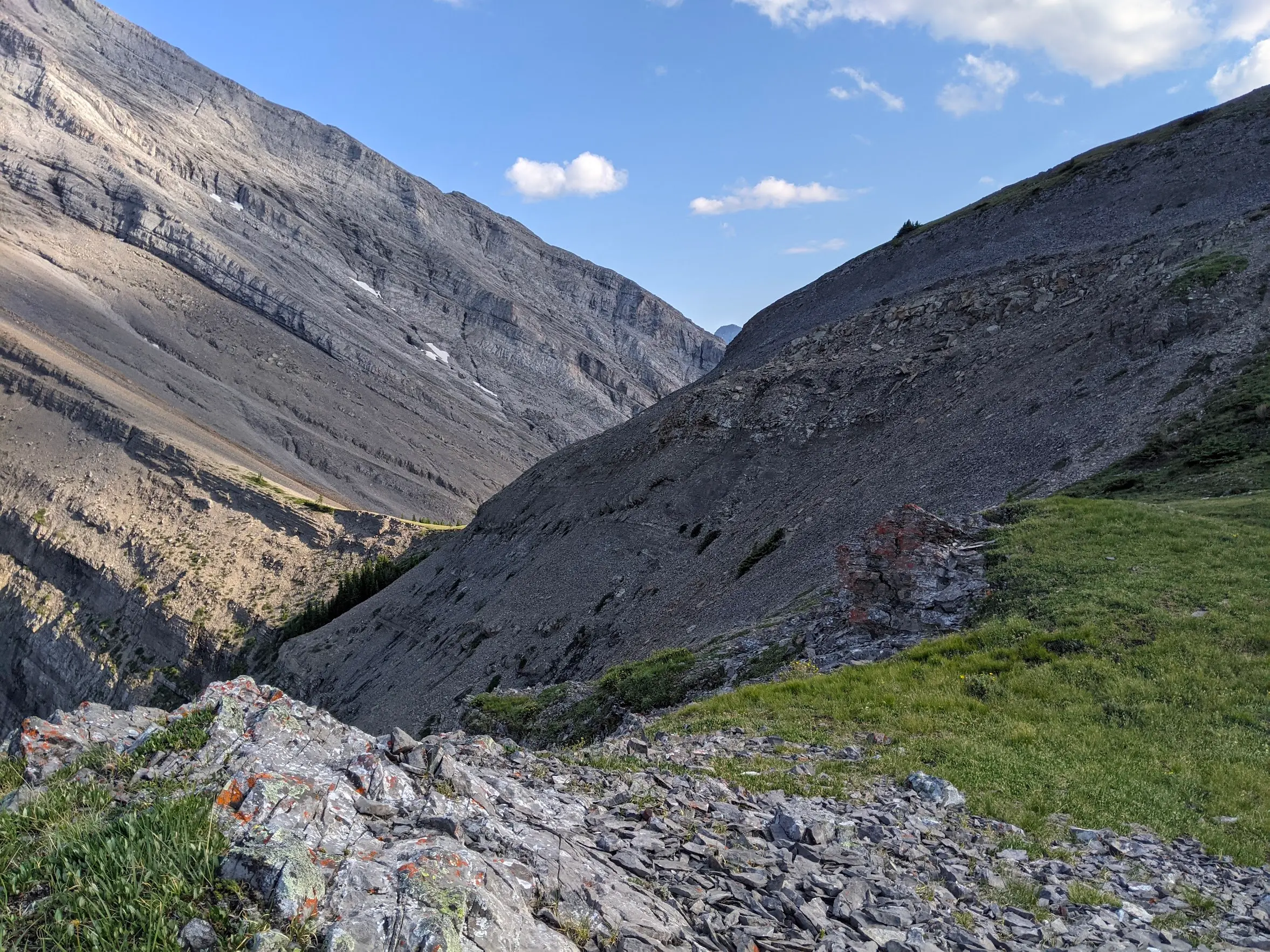
My map indicated that there was a route through the trees and shrubs to my left, but there wasn't one to be found. The satellite photo appears like a small patch of trees and grass but this wasn't the case. I found myself fighting my way through dense trees and what looked like avalanche debris from prior years. There was no clear route and it was challenging going. I was wearing shorts because it was a hot day, but I'd absolutely recommend better clothing. Gaiters, pants, long sleeve shirt. I'd put it in the BW3 category.
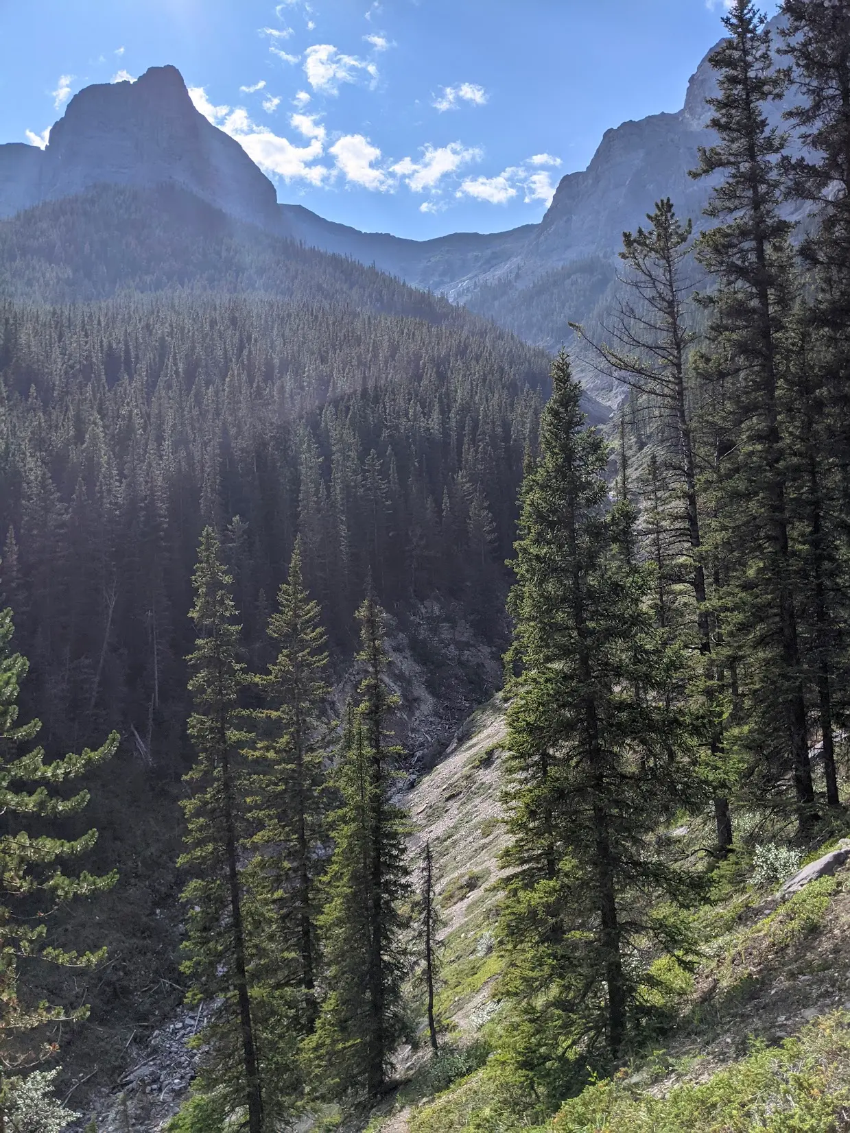
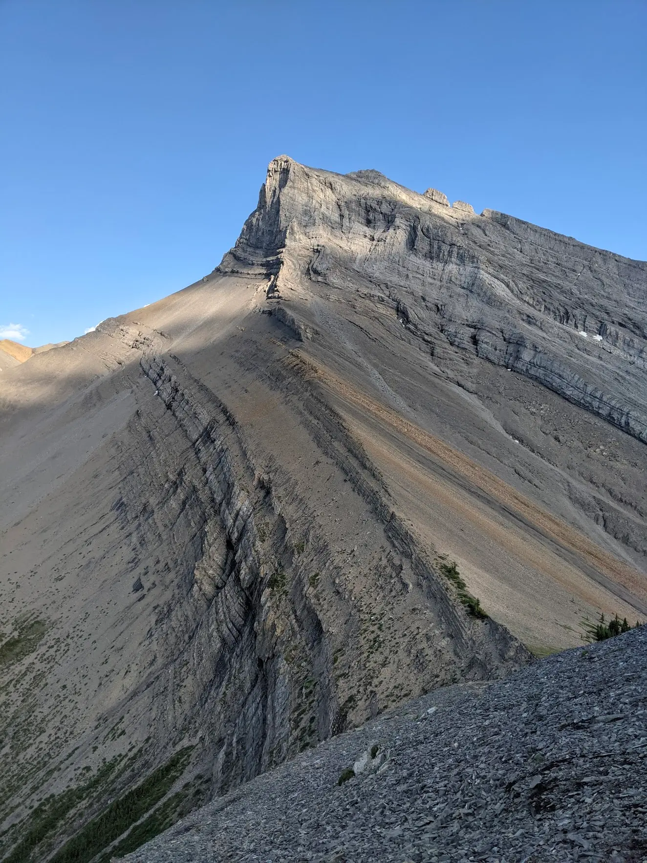
After fighting my way through the brush, I climbed a slope up to the top of the three sisters' pass. I called Emily and asked for a pickup from the other side, as I had originally considered backtracking, but there was no way I wanted to fight my way through that bush again.
I reached the top of the pass right at 7 PM, with lots of daylight left to descend.
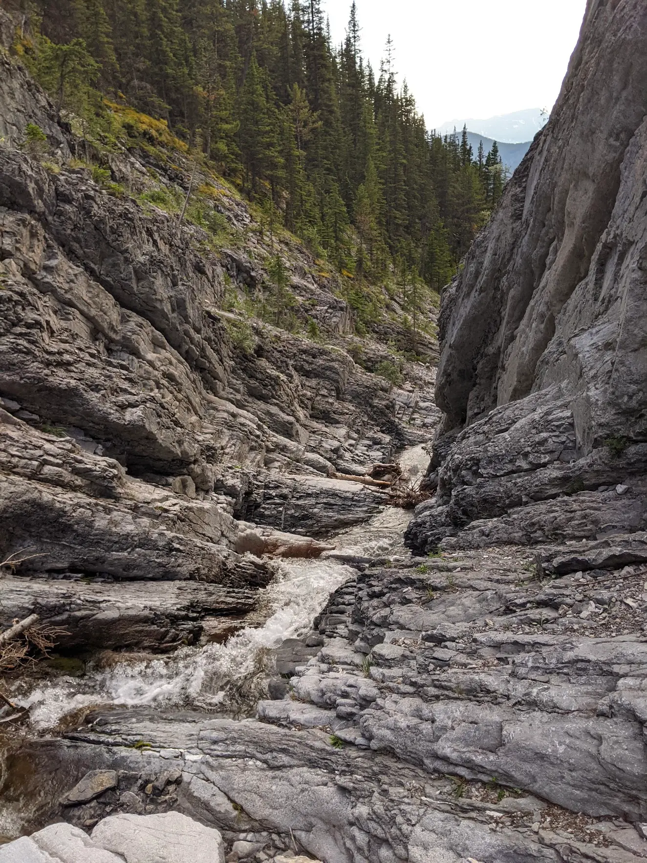
Descending down the creek to the Smith-Dorrien was easy enough, as there's a well-defined trail the whole way. The only challenge was avoiding the creek through a narrow passage after I had mistakenly stayed too low rather than staying high.
Fortunately, I didn't have to hitchhike my way home. Emily showed up only a couple of minutes after I arrived at the trailhead to pick me up at around 7:45 PM.